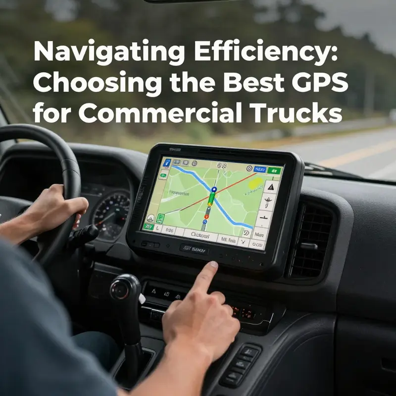
Selecting the best GPS for commercial trucks is essential for enhancing efficiency, safety, and cost management in fleet operations. As trucking remains a backbone of the logistics sector, understanding the technology that drives modern GPS systems is crucial. This article delves into the core technologies behind commercial truck GPS, evaluates key features to prioritize, compares leading brands, and offers insights from users regarding their experiences. Each chapter contributes to constructing a holistic view of finding the best GPS solution, ensuring that trucking company owners, fleet managers, and logistics firms make informed decisions that enhance operational success.
Navigating the Sky, Roads, and Regulations: How Modern GPS for Commercial Tractors Powers Safe, Efficient Fleets
Chapter 1 begins not with a single device but with a coordinated system that makes every mile count. The evolution of GPS for commercial trucking has shifted from a passive map to an active intelligence layer that speaks to trucks, their loads, and the wider network of roads, regulations, and seasonal realities. In today’s fleets, a GPS device is less about point A to point B and more about point A, B, and every constraint, permission, and opportunity in between. The most capable solutions treat the truck as a living asset within an ecosystem rather than a static traveler on a line drawn across a map. This shift is the cornerstone of what drivers, dispatchers, and fleet managers now expect from navigation technology: precision, adaptability, and a level of foresight that reduces risk and elevates reliability.
To understand why these systems matter so deeply, it helps to unpack what GPS means in this context. At its core, GPS is a satellite-based positioning framework that informs a device where it is in three-dimensional space and how fast it is moving. The satellites orbit Earth in well-defined planes, broadcasting continuous signals that a receiver on a truck can interpret to compute location, speed, and time. In civilian applications—as used by commercial fleets—this signal processing has always been about accuracy and availability. But the trucking world has driven a far more demanding standard. A driver’s route is not just about the few miles ahead; it is about the next bridge, the next weigh station, the route’s clearance under a rooftop of power lines, and the successive turns that must align with tight delivery windows. The system must know the length, height, width, and weight of the vehicle and the cargo, the permits that govern its movement, and the rules that apply to hazmat or seasonal restrictions. In this sense, GPS becomes a platform for truck-specific routing rather than a generic traveler’s guide.
As a platform, the technology rests on several pillars. First, there is the satellite backbone—the constellation of signals that any receiver interprets to estimate position. The civilian standard is designed to be accessible and dependable, providing a robust baseline of accuracy in most conditions. The second pillar is the receiver’s ability to fuse that positional data with real-time streams. Unlike consumer navigation, commercial trucking GPS must integrate traffic flow, weather conditions, road work, incidents, and dynamic legal constraints into every routing decision. The third pillar is vehicle-aware logic: the system must understand and apply vehicle dimensions, gross vehicle weight, axle configurations, trailer length, height clearances, and fuel needs while weighing these against road restrictions, temporary closures, or weight-restricted routes. Finally, there is the ecosystem surrounding the device—dispatch software, telematics, RFID or smart-card driver verification, and geofencing that turns the vehicle into a tracked unit with automated alerts and accountability.
The real magic emerges when these pillars harmonize. In simple terms, a truly intelligent trucking GPS doesn’t just tell a driver where to go; it orchestrates a safe, efficient journey by anticipating potential problems before they become real. The system’s routing engine evaluates countless route permutations in light of current conditions and the truck’s specific profile. It automatically avoids low bridges and narrow lanes that a standard car-oriented navigator might miss. It steers clear of weight-restricted highways when a truck’s load would exceed limits. It even factors in upcoming ramps or toll zones where a detour could save time or reduce wear on the vehicle. The value of this capability is not theoretical; it translates into meaningful gains in on-time deliveries, fuel efficiency, and compliance with a mosaic of federal, state, provincial, and municipal rules that govern heavy trucking.
Real-time data integration is the lifeblood of adaptive routing. Traffic incidents can cascade into delays far more quickly for heavy vehicles than for passenger cars. A modern trucking GPS not only detects congestion but also interprets its implications for a tractor-trailer in a particular corridor, taking into account the truck’s size and load. If a traffic incident creates a bottleneck with a spillover effect, the system can recalculate a new plan and present it with a few taps. Weather data adds another dimension. Snow, rain, fog, or high winds can impact braking distances, traction, and visibility, and the software can steer away from routes where conditions are deteriorating. For fleets that carry hazardous materials, weather-related routing becomes even more critical because certain climates and road surfaces can influence risk assessments during transit. The ability to react to changing conditions in real time helps drivers stay safe and helps dispatchers keep commitments to customers.
Beyond the road itself, GPS for commercial fleets has become a hub for fleet-wide intelligence. Vehicle-mounted terminals relay continuous status updates to dispatch centers, where managers observe live tracks, analyze historical driving patterns, and spot deviations from planned routes. This data stream supports more than just navigation; it informs maintenance scheduling, driver coaching, and operational planning. For example, consistent patterns of hard braking or rapid accelerations can indicate driver behavior that, when addressed, improves safety and reduces wear and tear on vehicles. In some fleets, driver identity is verified through RFID or smart cards, logging when a driver starts a shift, enters a loading zone, or returns to base. This layer of accountability is invaluable in regulated environments and helps prevent fatigue-related incidents and vehicle misuse. The net effect is a more transparent, auditable operation where every mile traveled is contextualized by purpose, conditions, and outcomes.
Geofencing adds yet another layer of control and insight. Virtual boundaries around loading docks, construction sites, or maintenance yards enable alerts whenever a truck crosses into or out of a designated zone. These triggers can be the basis for routine compliance reporting, schedule optimization, or early warnings about delays. In some configurations, the geofence integrates with outdoor dashboards that display dispatch instructions in the field, aligning shop floors, loading crews, and drivers in near real time. Taken together, these features turn GPS into an activity intelligence platform rather than a standalone map. The resulting operational clarity reduces downtime, enhances safety, and provides a foundation for better customer service through more reliable delivery windows.
As fleets look toward the future, the role of artificial intelligence in trucking navigation becomes increasingly pronounced. AI-based routing systems learn from vast amounts of historical and real-time data to anticipate patterns that a static routing algorithm would miss. They re-prioritize routes not only based on current conditions but also on predicted congestion, weather changes, and energy use implications for multiple vehicle types. This predictive capability aligns closely with broader fleet goals—maximize uptime, minimize fuel spend, and improve delivery reliability. Still, no single technology is a silver bullet. The value of an AI-powered GPS lies in how well it is integrated with a fleet’s data ecosystem, how accurately it models vehicle constraints, and how effectively it communicates its recommendations to drivers and dispatchers. In practice, the most effective solutions balance autonomous routing with human oversight, ensuring that the plan remains practical, compliant, and aligned with customer expectations.
The decision framework for choosing a GPS solution for commercial trucking is nuanced. It is not sufficient to chase the most advanced algorithmic claim or the most polished user interface alone. The true measure of value is whether the system respects the truck’s physical realities and the regulatory landscape while delivering consistent, actionable insights that can be translated into daily gains. A robust system should seamlessly ingest and harmonize data from telematics, weigh station records, permit databases, and carrier-specific rules, then translate that information into routing choices that drivers can trust and dispatchers can monitor. It should also support practical workflow enhancements, such as quick origin-destination planning, with the ability to generate optimized routes with minimal input. In this sense, a good GPS for trucks is part navigation tool, part operations platform, and part compliance engine. The integration across these dimensions is what transforms routing from a cost center into a strategic capability.
The electrification of fleets adds new layers of complexity—and opportunity—to GPS-enabled routing. Electric trucks bring considerations such as regenerative braking, charging durations, and charging location availability. A capable system can factor energy consumption estimates, the anticipated time to recharge, and the proximity of charging infrastructure to planned routes. It can propose alternatives that minimize downtime while preserving service levels. This evolving challenge is helping push GPS developers to integrate energy modeling with traditional routing logic, ensuring fleets can extend range without sacrificing reliability. For those curious about how these shifts are unfolding in practice and market context, readers may explore discussions around the broader shift toward electric trucks and its implications for routing and logistics in relevant industry coverage, such as Electric Trucks Revolutionize Canadian Market. This internal resource offers a concrete look at how electrification is reshaping planning horizons and capital investments for fleets.
To anchor this chapter in a broader technical context, it helps to recall what underlies the positioning framework in the first place. The Global Positioning System consists of a constellation of satellites orbiting Earth at substantial altitudes, providing signals that allow receivers to triangulate a precise location. In civilian applications, the level of detail is typically sufficient for road navigation, but the trucking use case demands much more. The precision of 25 meters under ideal conditions becomes an operational floor when you must determine lane assignments at a toll plaza, judge whether a route is volumetrically compatible with a trailer’s length, or verify compliance with height restrictions near overpasses. The U.S. government maintains the system to support civilian use, and modern receivers excel when they are paired with intelligent data streams that reflect real-world constraints. This combination has made GPS-enabled trucking navigation a backbone of safety, efficiency, and accountability in contemporary logistics networks.
From a practical standpoint, the value proposition of the best trucking GPS rests on reliability, adaptability, and the breadth of its data integrations. A device or app that only provides route suggestions without aligning to a fleet’s regulatory constraints or real-time conditions will quickly lose relevance. The most effective solutions fuse location data with vehicle attributes, load details, road restrictions, and dynamic external signals. They also provide an interface that drivers can trust and dispatchers can monitor in real time, so decisions are transparent and auditable. The ongoing challenge for developers is to maintain this integration across diverse jurisdictions, seasons, and freight categories, all while keeping interfaces intuitive enough for daily use in cab environments.
Finally, the question of “which GPS is best for commercial trucks” depends on context. For some fleets, the best choice is a system that mirrors the company’s operational model—tight integration with warehouse management, inventory control, and customer-facing delivery promises. For others, it is a lean solution that offers rapid origin-destination planning and reliable routing with strong driver support features. In all cases, the strongest candidates are those that treat routing as a dynamic, high-stakes decision-making process rather than a static map update. This perspective emphasizes not just where to go next but how to get there with the least risk, the most predictability, and the greatest compatibility with the fleet’s broader goals.
As this chapter closes, the reader should carry forward a clear sense of GPS as a technology that transcends navigation. It is an evolving platform for safety, efficiency, and compliance that grows smarter as fleets collect more data, integrate more systems, and demand more from their partners. The next chapters will translate these principles into practical guidance for evaluating features, weighing trade-offs, and choosing a solution that aligns with specific routes, loads, and regulatory environments. The end result is a fleet that doesn’t just travel faster, but travels with greater confidence, visibility, and accountability. For those who want a deeper dive into the electrification dimension and its impact on routing, consider the linked resource on Electric Trucks Revolutionize Canadian Market, which expands the conversation about energy-aware navigation. And for a broader technical grounding on GPS architecture and civilian applications, the official GPS overview offers authoritative context on the signals, accuracy, and civilian use cases that underpin every trucking navigation decision. External reference: https://www.gps.gov/systems/gnss/
Essential GPS Capabilities That Keep Commercial Trucks Moving Safely and On Time
Essential GPS Capabilities That Keep Commercial Trucks Moving Safely and On Time
Choosing the right navigation and tracking solution for commercial trucks is a strategic decision. It shapes daily routes, affects safety, influences compliance, and alters operating costs. Rather than chasing every shiny feature, prioritize capabilities that solve real trucking problems. This chapter walks through those capabilities and explains why they matter, how they interact, and what to look for when comparing systems.
Start with routing that understands the truck. Generic turn-by-turn directions are fine for passenger cars. For trucks, they can be dangerous. Effective truck routing takes vehicle height, length, weight, and load type into account. It removes low-clearance and weight-restricted roads from consideration. It avoids tight turns and lanes that a heavy rig cannot navigate. When routing reflects the truck’s physical profile and cargo, it lowers the risk of costly detours, fines, and accidents. Look for systems that let you set and save multiple truck profiles for different tractors and trailers. That flexibility streamlines planning when fleets run mixed equipment.
Real-time situational awareness is the second non-negotiable capability. GPS devices should provide live location, but they must also fuse traffic, construction, and severe weather updates into route decisions. When a highway closes or a storm creates hazardous conditions, the system should suggest safe alternatives quickly. This kind of dynamic rerouting protects delivery windows and reduces driver stress. Equally important is the latency and frequency of updates; stale data is worse than no data. Choose platforms that offer frequent, low-latency feeds and clear indicators when information is delayed or uncertain.
Telematics and sensor integration move a GPS device from a map to a fleet intelligence tool. Beyond location, modern systems ingest engine diagnostics, fuel usage, idling times, and driver behavior metrics. That data matters because it translates into dollars. Fuel wasted by inefficient routing, excessive idling, or aggressive driving adds up fast. Systems that surface actionable telematics let managers pinpoint coaching opportunities and measure the effects of improvements. Integration with on-board diagnostic ports and standardized telematics protocols ensures the data is reliable and consistent across a fleet.
Compliance features are tightly linked to telematics. Hours-of-service tracking, automated duty status logs, and event recording help fleets comply with regulations. A capable GPS and telematics solution should export data in formats that auditors expect and integrate with electronic logging systems. When compliance data is automated, it reduces paperwork, minimizes human error, and protects against costly violations. For operations that cross state or national borders, ensure the provider supports the regulatory requirements in each jurisdiction.
Geofencing and geospatial rules are practical tools for operational control. Virtual boundaries trigger alerts for arrivals, departures, and unauthorized use. They also enforce route restrictions when combined with truck-aware routing. For example, geofences around environmentally sensitive areas or customer loading zones can prompt alternative behaviors or confirmations from drivers. Alerts should be configurable and deliverable through multiple channels, such as dashboards, SMS, or email, so dispatchers and managers never miss critical events.
Durability and power resilience matter on long hauls and in harsh conditions. Hardware should tolerate wide temperature swings, vibration, dust, and moisture. If a device relies on battery power, its runtime and recharge cycle must match operational realities. Hardwired units avoid battery limitations but require professional installation. Consider removable, swappable power modules if downtime for maintenance is a concern. Above all, choose ruggedized components that minimize service interruptions and survive in-cab conditions over years, not months.
User experience often determines whether a system delivers value on the road. Drivers need interfaces that minimize distraction and simplify tasks. Fleet managers need dashboards that make patterns obvious and let them act quickly. Systems that require elaborate training or frequent support calls create adoption friction. Seek platforms with intuitive mobile and web apps, clear visualizations, and straightforward reporting. Training resources, onboarding assistance, and accessible technical support are part of the product. A responsive support team reduces downtime and accelerates returns on investment.
Data security and ownership deserve attention. Fleet location and performance data are sensitive. Providers should encrypt data in transit and at rest. They should provide clear policies on data ownership, retention, and export. The ability to extract raw data for internal analysis or third-party tools prevents vendor lock-in. Also, consider options for role-based access and audit logs so sensitive information is available only to authorized users and all changes are traceable.
Scalability and integration determine long-term fit. A solution must grow as your fleet grows. Cloud-based architectures typically scale more easily than on-premises setups. Seek modular platforms that connect with dispatch software, maintenance systems, payroll, and routing optimization tools. Open APIs and standardized data formats make integrations smoother and cheaper. When a GPS solution fits into an existing software ecosystem, it amplifies value rather than creating data silos.
Map data quality and update cadence are often overlooked, but they drive core routing accuracy. Maps must include truck-specific restrictions and be updated often enough to reflect new restrictions or road changes. The provider’s map sources and update frequency matter because even the best routing engine fails with bad maps. Ask about map refresh schedules and how the provider incorporates local restrictions and municipal changes.
Predictive features are a differentiator where they exist. Systems that analyze historical patterns can suggest departure times, estimate arrival windows more accurately, and predict potential delays. Predictive ETA helps planners sequence loads and set customer expectations. Look for platforms that use historical performance and live conditions to refine predictions rather than relying on static distance-based calculations.
Cost structure should be transparent. Some providers charge by device, others by vehicle or by feature tier. Consider total cost of ownership, including installation, training, recurring subscription fees, and potential integration costs. Avoid solutions with hidden fees for maps, updates, or routine support. A clear, predictable pricing model simplifies budgeting and lets you compare offerings on an apples-to-apples basis.
Driver acceptance is equally important. Features that reduce workload tend to improve acceptance. Voice-guided routing, one-tap status updates, and minimal manual data entry all help. Involve drivers early in evaluations and pilots. Their insights will reveal usability issues and edge cases that desktop demos miss. When drivers feel a system helps them, compliance and engagement improve naturally.
Finally, evaluate vendor reliability and roadmap. The right partner invests in trucking-specific capabilities and maintains an active update cadence. They listen to customers and adapt features accordingly. A vendor that treats trucks as an afterthought will slow your progress. Seek providers with a demonstrated history of updates, clear product roadmaps, and strong references from peers.
Choosing a GPS solution for commercial trucks means balancing safety, efficiency, and cost. Focus on truck-aware routing, real-time data fusion, robust telematics, durability, and strong usability. Verify compliance features, map quality, integration options, and data security. Factor in predictable pricing and driver acceptance. These capabilities combine to protect your assets, improve on-time performance, and reduce operating costs.
For further reading on GPS tracking system features and industry best practices, consult this practical guide: https://www.fleetmanagement.com/gps-tracking-systems-features. To explore broader operational topics related to buying and selling trucks and optimizing fleet assets, see the company resource on buy-sell-trucks-campers-efficiently.
Head-to-Head: Choosing the Best GPS Strategy for Commercial Trucks
Choosing the right navigation approach for commercial trucks means balancing safety, efficiency, and total cost of ownership. Truck operators need systems that understand vehicle dimensions, weight restrictions, and cargo types. They also need real-time awareness of traffic, weather, and temporary hazards. The leading solutions on the market fall into clear categories: premium dedicated hardware, rugged fleet devices, compact professional units, smartphone-based navigation apps, and cloud-native AI routing platforms. Each category answers a different set of operational priorities and constraints.
Premium dedicated hardware is designed for drivers who demand precision and resilience. These units feature large, high-resolution displays and robust truck-specific routing engines. They let teams store multiple vehicle profiles, so a tractor-trailer, a straight truck, and a box van can each have tailored routing rules. Critical attributes include the ability to avoid low-clearance structures, weight-restricted bridges, tight turns, and prohibited roads. Built-in satellite imagery and layered map detail help drivers assess approach conditions visually before committing to a route. These units often include wind-speed alerts and integrated community-sourced parking availability, which reduces the time spent searching for safe rest or layover spots.
Rugged fleet devices take the premium model and harden it for constant, long-haul use. They emphasize durability, secure mounting options, and reliable power management. Fleet-targeted features include centralized management for map and firmware updates, automated logging for compliance, and straightforward integration with dispatch systems. Operators who manage multiple drivers value centralized control. They can push route restrictions, configure preloaded points of interest, and gather usage metrics without interrupting drivers. The trade-off is typically price and the need for more formal installation.
Compact professional units occupy the middle ground. Smaller screens and lighter hardware reduce cost and cockpit footprint. These devices still apply truck-specific constraints when calculating routes, and they usually support a variety of cargo and vehicle configurations. For smaller fleets and owner-operators, compact units strike a balance between professional routing and affordability. They often pair with mobile apps for trip planning, allowing a dispatcher to prepare routes remotely. The downsides are fewer built-in fleet-management tools and sometimes slower map refresh cycles compared to fleet-grade units.
Smartphone-based navigation apps have matured quickly. Modern apps deliver truck-aware routing, offline maps, and crowd-sourced reports on parking, road hazards, and weigh stations. They excel at low upfront cost and fast updates. For short runs, regional work, or part-time drivers, a well-configured app can match the essentials of a dedicated unit. However, phones require robust mounting, reliable power, and ruggedization to stand up to long-haul vibration and temperature extremes. They also depend on cellular coverage for many of their live features, so they can underperform in remote areas without service.
Cloud-native AI routing platforms represent the newest approach. These systems fuse vehicle profiles, live traffic, weather feeds, and historical route performance into a continuously learning model. Instead of fixed rules, they create adaptive routes that account for cargo type, expected load distributions, and real-time restrictions. When conditions change, they reroute proactively, minimizing delays and safety risks. Such platforms often expose APIs for telematics and fleet management systems, letting operators automate route assignment and optimize fuel efficiency across an entire fleet. The most advanced implementations reduce incidents of being routed onto unsuitable roads and lower operating costs through smarter, context-aware decisioning.
Across these categories, a few functional themes determine real-world value. The first is truck-specific routing. Any recommended solution must let users input height, width, length, and weight. It also should allow for special cargo restrictions, like hazmat limitations. Systems that lack granular vehicle profiles risk putting drivers into dangerous or illegal situations.
The second theme is dynamic rerouting with live data. Traffic congestion, road closures, and severe weather are common in commercial operations. Solutions that pull in multiple live feeds — traffic, roadwork, weather, and official restrictions — provide safer, more reliable arrival times. Equally important is the speed of that reroute decision. A system that updates every minute often outperforms one that relies on periodic refreshes.
Third, community-driven data remains surprisingly effective. Driver-reported parking spots, dock access notes, and temporary hazards often beat static databases. Platforms that combine verified official sources with crowd contributions give drivers practical, timely insights. The ideal system highlights confidence in each report, allowing drivers to weigh the reliability of community items.
Fourth, integration matters. Navigation is rarely a stand-alone purchase. Dispatch, telematics, ELDs, and load planning systems must communicate with navigation to minimize double entry and to enforce consistent routing rules across operations. Solutions that offer open APIs, exportable route logs, and easy integration save hours per week and reduce human error.
Fifth, durability and support affect long-term cost. Hardware warranties, access to timely map updates, and responsive technical support reduce downtime. For app and cloud solutions, a transparent update cadence and clear offline capabilities matter more than flashy features. A pragmatic buyer checks the vendor’s map update policy and replacement terms before committing.
Selecting among these options depends on operational profile. Long-haul carriers with consistent, heavy loads often prioritize rugged units and cloud routing platforms with fleet management. Regional carriers with mixed vehicle types benefit from mid-range devices that balance cost and capability. Owner-operators and part-time drivers may favor small professional units or smartphone apps, particularly if they value mobility and low initial investment.
Cost analysis should go beyond sticker price. Consider the total cost of ownership over three to five years. Factor in subscription fees for traffic and map services, the cost of fleet integration, installation labor, and downtime for device failures. AI routing platforms typically entail recurring fees, but their route efficiency gains can offset those costs through fuel savings and reduced delay expenses. Hardware-only buys might look cheaper initially, but they can require periodic replacements and paid map updates.
Training and user experience deserve attention. Drivers adopt tools that help them finish work faster and safer. Systems with clear, uncluttered interfaces and straightforward vehicle profile setup reduce training time. Equally, customizable alerts that respect driver preferences while enforcing company rules help maintain compliance without overwhelming drivers.
Finally, plan for future needs. The industry continues to evolve around electrification, emissions reporting, and increasingly granular regulatory requirements. Navigation solutions that can incorporate charging station locations, low-emission zones, and evolving weight or routing restrictions protect investments over the long term. Open platforms that accept new data sources and integrate easily with fleet software will adapt with changing regulations and operational models.
For an operator deciding which direction to take, start with a concise list of must-haves: exact vehicle constraints, required live feeds, necessary fleet integrations, and acceptable budget range. Pilot the shortlisted options with real routes, not simulated drives. Measure outcomes such as on-time rate, time spent searching for parking, and fuel consumption changes. Pilots reveal differences that spec sheets rarely show.
A useful primer on market comparisons and performance benchmarks is available in a recent expert review. It summarizes model performance, pros and cons, and real-world feedback from professional drivers: https://www.drivers1st.com/gps-comparison-2025
For broader operational context on how navigation decisions interact with market forces and fleet strategy, see the discussion on “Navigating Economic Uncertainties” in trucking markets: Navigating Economic Uncertainties.
The path to the best GPS choice is practical. Match the solution category to your operational scale and complexity. Prioritize truck-aware routing, live data integration, durable hardware, and smooth fleet integration. Test in the real world and measure economic impact. With that approach, navigation becomes a measurable contributor to safety and profitability rather than just another expense.
Voices from the Cab: Real-World Impressions on the Best GPS for Commercial Trucks
Driver feedback is the final arbiter of usefulness when a cab technology promises to keep freight moving and drivers safe. In the realm of commercial truck navigation, the devices that earn top marks are not those that merely display a map, but tools that understand the realities of the road – truck dimensions, cargo constraints, and regulatory compliance – while delivering reliable data, intuitive usability, and tangible safety benefits. What drivers repeatedly lecture back to manufacturers and fleet managers is that the best GPS for trucking is the one that disappears into the routine of a day on the road rather than demanding constant fiddling. It is the system that lets a driver focus on navigation as a seamless extension of the job, not a distraction from it. With that benchmark in mind, drivers describe a spectrum of experiences that illuminate why certain devices rise above the rest and why others fall short in the long haul.
A recurring theme in the praise for top-tier truck navigators is their ability to render truly intelligent routing that respects the truck’s unique profile. In the real world, a route is not just about the shortest distance. It is about finding a path that accommodates trailer length, overall height, weight limits, and the nature of the cargo on board. Drivers report that the most trusted truck navigators automatically filter out routes that could trigger bridge or weight restrictions, or places with infrastructure that simply cannot accommodate a commercial vehicle. The value here goes beyond avoiding a failed delivery; it’s about avoiding a potential safety risk and the administrative headache that follows, such as fines, delays, or the need to reroute mid-journey with little margin for error. When a device translates dimensional data and cargo type into routing logic, it earns credibility in the cab. The consistency of this behavior – the predictable, rules-based routing – becomes a driver’s safety net, a quiet assurance that the device is doing more than showing a map.
Final thoughts
In conclusion, selecting the best GPS for commercial trucks is vital for maximizing operational efficiency, ensuring safety, and enhancing cost-effectiveness. A thorough understanding of the technology, key features, and brand comparisons equips trucking company owners, fleet managers, and logistics professionals to make informed decisions. By emphasizing user experiences, the importance of advanced GPS systems like TruckMap.AI is underscored as they cater to the unique demands of commercial fleets. Ultimately, investing in the right GPS technology will streamline navigation, improve delivery times, and mitigate risks associated with trucking.